
Country highlight map
Type a country and it is coloured, framed and labelled for you, with its neighbours ready to light up. Download the finished map as a PNG for slides and thumbnails, or as a short MP4 where each country appears on cue.
Loading the editor…
Examples ready to edit
Every picture is a frame from a free export. Open one, change any place, colour or date.
A picture or a video
Download the finished map as a PNG, or as an MP4 where the country and each neighbour appear on cue.
Neighbours found for you
Every country that shares a land border is listed. Keep, reorder or remove them, or add any other country.
Four map styles
Natural terrain, a clean light map, a dark news look or vintage paper, with your own colours and font.
Country highlight map: the facts
- Price
- Free: all three tools, 720p and 1080p MP4 at 30 fps, with a small watermark. Creator ($9.90/month or $89/year, opening soon): no watermark, 60 fps, 4K, transparent background.
- Shots
- Country spotlight (a country and its neighbours), route (city to city by plane, train, car, boat or on foot), campaign arrows (armies, battles, dates)
- Output
- MP4 (H.264) in 16:9, 9:16 or 1:1, or a PNG still. No sound: it goes on top of your voice-over.
- Timing
- Press Space along your voice-over and each cut lands where you pressed; drag one cut and the others stay put.
- Map
- Natural Earth (public domain): countries, coastlines, rivers, lakes, about 7,300 cities, shaded terrain. Place names in 15 languages.
- Needs
- Chrome or Edge on a computer. Nothing to install, no account, nothing uploaded: the video is rendered on your machine.
Updated .
How to make a country highlight map
- Pick the country. Search by name in any of the 15 place-name languages, or by its ISO code. The map frames it in the middle of the picture, with room for a title above.
- Choose which neighbours to show. Every country that shares a land border is listed for you. Remove the ones you do not need, drag the rest into order, or add any other country with “Add any other country”, for example an ally across the sea.
- Write the labels. Add a title and subtitle, and a short note under the country name such as its area or population.
- Pick a look. In the Style tab choose the map style, the highlight colours, the font and whether borders and rivers are drawn.
- Download. Choose Still image (PNG) in the export dialog for a picture, or MP4 video for the animated version. Both are rendered on your computer.
One country highlight map, two outputs
A still map and an animated one usually come from different tools. Here they are the same project. The PNG is the final frame of the animation: the country filled in the highlight colour, its neighbours outlined and lightly tinted in the second colour, every label in place. The MP4 builds up to that frame, lighting the country first and then each neighbour in the order of your list.
That makes it easy to use the same map twice: as a thumbnail or slide, and as the shot inside the video where you talk about it. Change a colour once and both versions follow.
The examples: Vietnam, Egypt and Switzerland
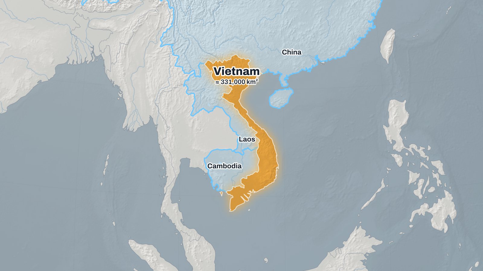
- Vietnam on the light map, with China, Laos and Cambodia. The note under the name gives its area, about 331,000 km².
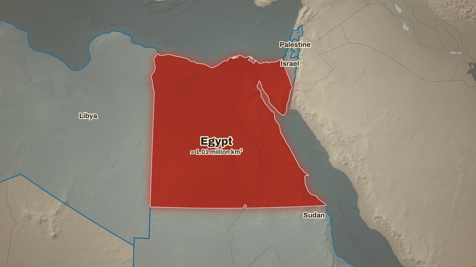
- Egypt on the vintage map, with Libya, Sudan, Israel and Gaza. Israel and Gaza light up together, using “with above”.
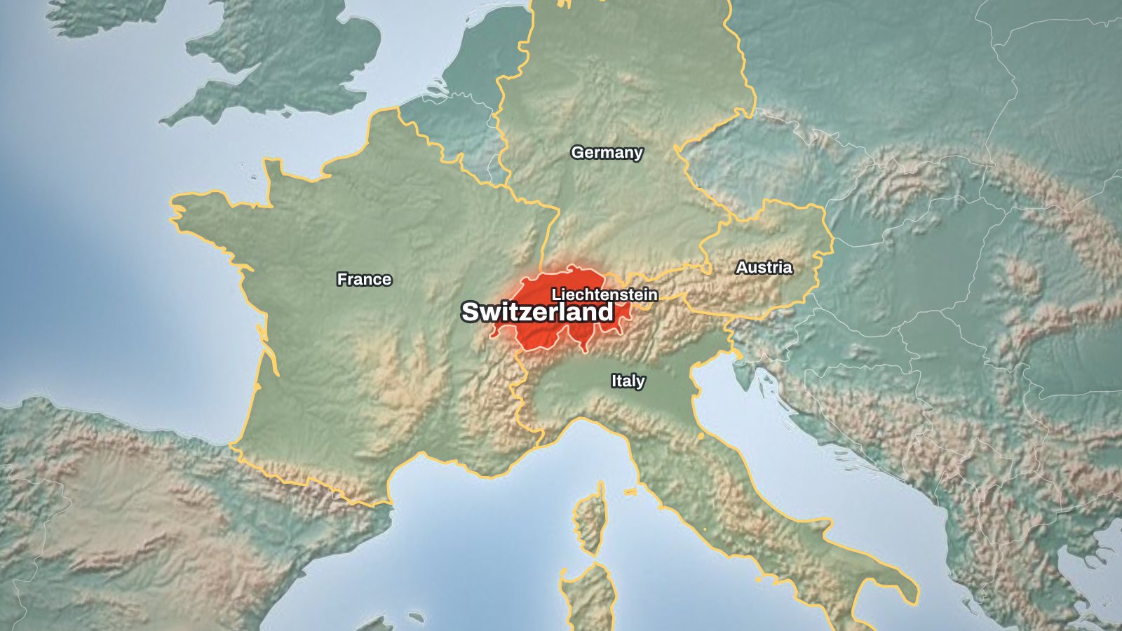
- Switzerland on the natural terrain map, with its five neighbours. The Alps show in the shaded relief, which explains the borders better than a flat colour.
Replace the country in any example and the neighbours, the framing and the labels are worked out again.
Map styles for a highlighted country
Four base styles cover most uses. Natural shows shaded terrain and hypsometric colours, so mountains, deserts and river valleys are visible around the highlight. Light is a clean flat map that reads well on slides and printed handouts. Dark is the news look, with a glowing highlight. Vintage is a paper map with serif type for history topics.
On top of the style you set the main highlight colour, the colour for neighbours, a sans or serif font, and whether borders, rivers and lakes are drawn. Save the combination as a channel style and every new map starts from it.
Labels that stay readable
The highlighted country is labelled in its centre with your note underneath. Neighbour names are placed inside the visible part of each neighbour, away from the main label, so a large neighbour such as Russia or China does not push its name off the picture. Place names can be shown in English, Spanish, Portuguese, French, German, Italian, Turkish, Indonesian, Russian, Hindi, Arabic, Japanese, Korean, Chinese or Vietnamese.
Uses for a country highlight map
- YouTube thumbnails and title cards for geography, news and travel videos.
- Slides and handouts for a lesson, a lecture or a school project on one country.
- Reports and pitch decks that show where a company operates or where a market is.
- Social posts in 1:1 or 9:16, with the same framing as the video.
For a fly-in from the globe, use the animated world map. For journeys between places, use the travel map animation.
Map data and borders
Countries, coastlines, rivers and lakes come from Natural Earth, a public-domain dataset, drawn at 1:50 million scale. Neighbours are worked out from shared borders in the more detailed 1:10 million data, so short borders such as Spain and Andorra are not missed. Borders follow Natural Earth's default point of view; where territory is disputed, check the border your work depends on against an authoritative source.
States, provinces and regions inside a country are not drawn yet. Highlighting several countries at once works through the neighbour list and “Add any other country”.
Free country highlight map download
PNG stills and 720p or 1080p MP4 videos are free, with a small watermark showing the site's address in a corner. You do not need an account; your projects are kept in your browser on this computer. A paid Creator plan without the watermark, with 4K and a transparent background, is opening soon.
Country highlight map FAQ
Can I download the highlight map as an image?
Yes. In the export dialog choose “Still image (PNG)”. You get the final frame at 720p or 1080p (4K with Creator), in 16:9, 9:16 or 1:1.
Can I highlight several countries that are not neighbours?
Yes. Use “Add any other country” under the neighbour list. Every country in the list is outlined and lightly tinted in the second highlight colour.
Can I use two colours, one for the main country and one for the others?
Yes. The main colour fills the country you picked; the second colour outlines and tints the neighbours and added countries. Set both in the Style tab.
Can I highlight states or provinces?
Not yet. The map works with countries; states and provinces are on the list of ideas.
Can I remove the labels?
You can clear the title, subtitle and note. Country names stay on, because the map is meant to be read without narration.
Is there a transparent background?
For MP4 and PNG stills the background is the map style. Transparent PNG frames for layering over footage are part of the Creator plan.
Which countries can I highlight?
Every country in Natural Earth’s 1:50 million dataset, including small ones such as Liechtenstein or Singapore, which are framed together with their surroundings.
Other map shots
 Animated world mapThe globe turns, the camera flies in and the country lights up, then its neighbours one by one in your order.
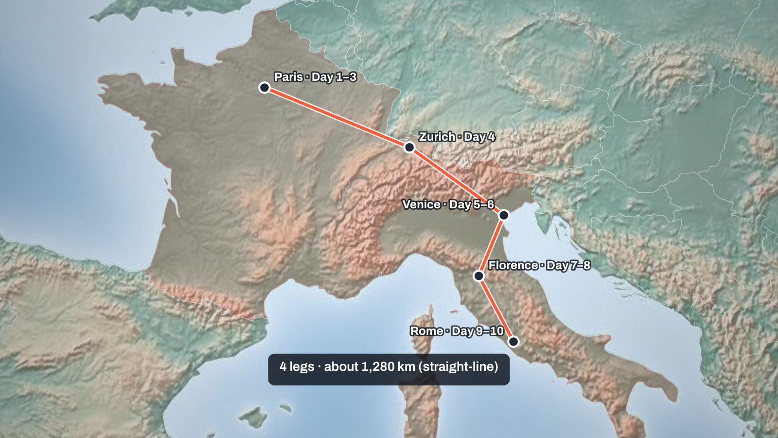 Travel map animationPlanes fly a dashed great-circle line, trains and cars a solid one, boats a long dash, walks a dotted line. Each leg can differ.
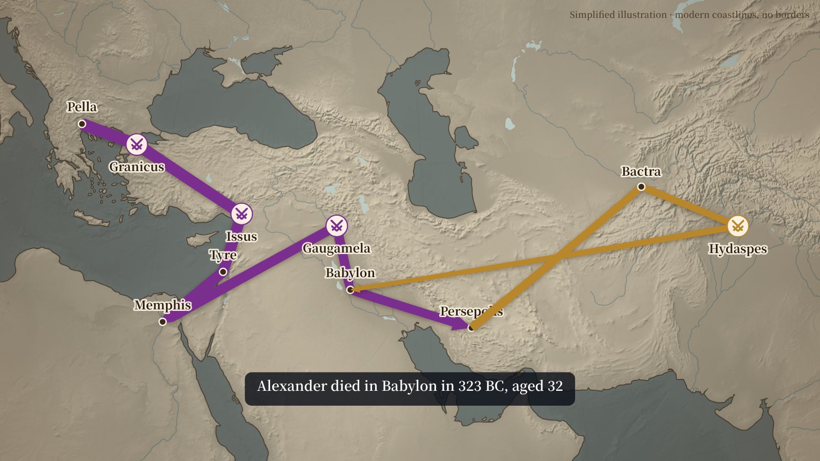 War map makerSet how wide an arrow starts and ends. A thick advance that ends thin tells viewers the army lost men, without a number on screen, the way Minard drew 1812.